
When is ground-based verification required after aerial methane detection?
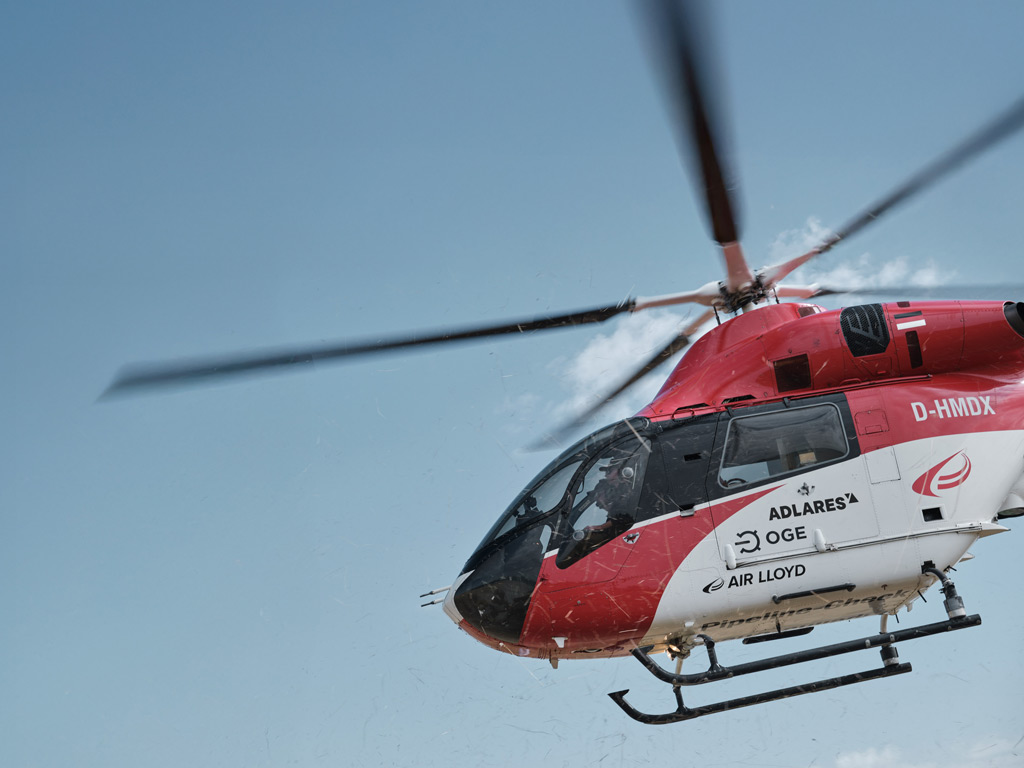
Learn when aerial methane detection legally requires ground verification, and what operators must do next.
October 20, 2026
Ground-based verification is required after aerial methane detection when an airborne survey registers a gas indication that exceeds a defined threshold, cannot be attributed to a known benign source, or falls within a high-consequence area. In practical terms, most pipeline operators treat any confirmed aerial indication as a trigger for a follow-up ground inspection, though the urgency and method depend on the indication’s severity and location. The sections below walk through the key questions operators face when deciding how to act on airborne survey results.
What triggers a ground-based follow-up after an aerial methane survey?
A ground-based follow-up is triggered when an aerial methane survey detects a gas indication that cannot be resolved from the air alone. Specifically, this means the airborne sensor has identified a methane concentration above background levels at a location consistent with pipeline infrastructure, and the data cannot be explained by surface-level interference such as agricultural activity or traffic emissions.
In practice, operators typically act on three categories of trigger. First, any indication classified as a confirmed or probable leak based on signal strength and spatial correlation with the pipeline route. Second, indications located near population centres, road crossings, or other sensitive infrastructure where the consequences of an actual leak would be significant. Third, repeated indications at the same location across successive survey passes, which suggest a persistent rather than transient source.
The speed of the ground response also matters. A high-magnitude indication in an urban area may require same-day dispatch, while a low-level indication in a rural corridor may be scheduled for verification within a standard maintenance window. Operators using a web-based GIS platform to review survey results can prioritise and assign follow-up tasks directly from the data, reducing the time between detection and action.
How do operators classify aerial methane indications before dispatching crews?
Operators classify aerial methane indications using a tiered system based on signal strength, spatial context, and the probability that the source is the pipeline itself. A typical classification scheme separates indications into confirmed, probable, possible, and background categories, with each tier carrying a different response obligation and timeline.
Signal strength is the primary input. DIAL-based systems measure the integrated methane column above the ground surface, so a strong, narrow signal directly over a pipeline is treated very differently from a diffuse, broad signal that could originate from multiple sources. Spatial context adds a second layer: an indication over a known valve station or compressor site carries more weight than one over open farmland.
Operators also consider wind conditions recorded during the survey. Methane plumes drift downwind, so a skilled analyst will account for wind direction when mapping an indication back to its probable source point. This analysis is built into the post-processing workflow and delivered alongside the raw data, giving ground crews a precise location to investigate rather than a general corridor.
What are the limitations of aerial detection that ground surveys resolve?
Aerial methane detection excels at covering large distances quickly and identifying where along a pipeline route a leak may exist, but it cannot pinpoint the exact leak point, confirm the source unambiguously, or measure the precise leak rate at ground level. Ground surveys close these gaps by bringing technicians and portable instruments directly to the location.
The core limitation of airborne detection is spatial resolution at the surface. Even at low survey altitudes of 100 to 150 metres, the sensor integrates methane over a column of air, meaning the detected signal represents a volume rather than a precise point. A ground crew using a flame ionisation detector or equivalent instrument can walk the pipeline route and locate the exact fitting, joint, or corrosion point responsible for the emission.
Ground surveys also resolve ambiguity around non-pipeline sources. Landfill edges, agricultural soils, and certain industrial processes all emit methane, and while experienced analysts can often distinguish these from pipeline leaks in the aerial data, a ground visit provides definitive confirmation. This is particularly important when the aerial indication is classified as possible rather than confirmed, because dispatching a repair crew to a false positive wastes resources and time.
When can ground verification be skipped or deprioritised?
Ground verification can be deprioritised when an aerial indication is clearly attributable to a known non-pipeline source, when the signal falls below the operator’s defined action threshold, or when a previous ground inspection at the same location has already ruled out a pipeline leak within a recent timeframe. It is rarely skipped entirely for confirmed indications.
Operators apply engineering judgement when the aerial data shows a diffuse, low-level signal in an area with documented surface methane sources such as wetlands or active agriculture. In these cases, the indication may be logged and monitored across future survey cycles rather than triggering an immediate ground response. If the signal persists or strengthens in subsequent surveys, the priority is escalated.
There is also a practical consideration around access. Some pipeline segments cross terrain where ground access is difficult or hazardous. In these situations, operators may use drone-based or vehicle-mounted detection as an intermediate step before committing to a full ground crew deployment. The aerial data still informs where to focus those secondary efforts, reducing the area that needs to be covered on the ground.
How does the EU Methane Regulation affect verification requirements?
The EU Methane Regulation, which came into force and is being progressively implemented through 2026, introduces mandatory leak detection and repair (LDAR) obligations for gas infrastructure operators across the European Union. Under Type 2 requirements for underground equipment, operators must use detection methods with sufficient sensitivity to identify leaks that would previously have gone undetected, and aerial surveys using DIAL technology are recognised as a compliant approach for covering large pipeline networks efficiently.
The regulation does not simply require detection; it also sets timelines for repair and verification of repair. Once a leak is identified, operators must document it, classify it, and act within prescribed timeframes depending on the leak grade. This creates a formal chain of evidence that begins with the aerial survey data and continues through ground verification, repair, and post-repair confirmation.
For operators, the practical effect is that aerial methane surveys are no longer just a best-practice tool but a regulatory instrument. The data generated must meet defined quality standards, be traceable, and feed into a documented LDAR programme. This raises the importance of working with detection systems that produce audit-ready outputs and that have recognised approval status, such as DVGW approval, which confirms compliance with European technical standards for gas remote detection.
How ADLARES supports your aerial and ground verification workflow
We provide end-to-end airborne gas leak detection services built around our CHARM® technology, the world’s only DVGW-approved remote gas detection system. Our service is designed to make the full workflow from aerial survey to ground verification as efficient and well documented as possible.
- High-sensitivity aerial surveys: CHARM® detects leakage rates from 150 litres per hour at survey speeds of up to 180 km/h, covering large pipeline networks quickly while meeting EU Methane Regulation Type 2 sensitivity requirements for underground equipment.
- Classified, actionable results: Survey indications are delivered through a secure Web GIS platform accessible on desktop and mobile, with each indication classified and spatially mapped so ground crews know exactly where to go and what priority to assign.
- Audit-ready documentation: Our outputs are structured to support LDAR programme documentation, giving operators the traceable evidence chain required under the EU Methane Regulation.
- Proven scale: We have inspected over 250,000 km of gas pipelines across Europe for major grid operators, giving us deep experience in translating aerial data into practical ground verification priorities.
If you are planning your next pipeline inspection programme or want to understand how aerial detection integrates with your existing ground verification process, get in touch with our team to discuss your network and requirements.
Related Articles
- What are the leak repair requirements under the EU Methane Regulation?
- Can LDAR programs reduce methane emissions and operational costs?
- Can aerial inspection methods satisfy DVGW G501 compliance conditions?
- How do you prepare a high-pressure pipeline for a DVGW G501 inspection?
- How are methane hotspots identified and prioritised during aerial survey campaigns?
This content was generated with the help of AI and it may contain mistakes